Utilities inspection
The DeltaQuad Pro #MAP is a leading transmission line inspection drone. It can survey up to 100KM of power lines or water pipes or up to 1200ha of solar panels in a single flight, and monitor remote sites up to 50KM distance, using high resolution Thermal and RGB video. It does this fully autonomous and can fly predefined corridors with automatic terrain following.
 Inspect power lines and isolators
Thermal monitoring of solar panels
Identify potential hazards to underground pipelines
Locate water leaks
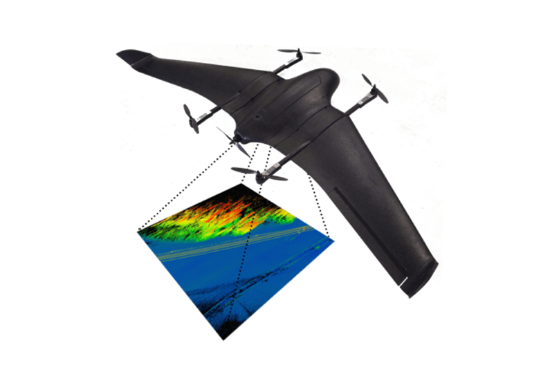
The DeltaQuad Pro records both Thermal and RGB video feeds simultaneously with embedded geo-coordinates. It can fly long distances, even beyond radio range. The recorded videos are easily retrieved from the on-board sd-cards and can be reviewed and analyzed in great detail.
Orthomosaic & 3D mapping
Aerial intelligence with CM level accuracy for planning, construction and maintenance of utilities.
Plan and prepare pole construction with CM level accurate orthomosaic maps
Digitize power grids with 3D point clouds
Monitor and report on construction progress
Map road access conditions and assess construction costs
Monitor erosion, ground displacement and vegetation activities
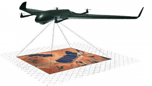
The DeltaQuad Pro #MAP provides high resolution imagery combined with CM level accuracy geo-referencing to produce highly accurate orthomosaic maps, 3D models and Digital Surface Models. Using terrain following corridor scans and automatically generated area surveys the DeltaQuad Pro #MAP makes aerial data collection effortless and easy to obtain.
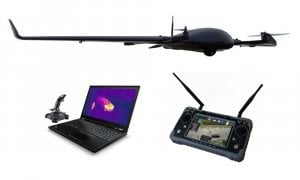
Live thermal and RGB video with the DeltaQuad Pro #VIEW
The DeltaQuad Pro #VIEW provides live Thermal and HD RGB video for aerial reconnaissance of remote sites. With up to 50KM video range, or unlimited range using the mobile network.
Live HD video of hard to reach areas
Actionable intelligence for emergencies and natural disasters
Live reconnaissance of breakage or spills
Improve employee safety with aerial reconnaissance in dangerous areas
The DeltaQuad Pro #VIEW provides joystick control of both High Definition and Thermal video live from a stabilized camera gimbal. While the vehicle flies fully autonomous, or guided to areas of interest, a camera operator can move, zoom in and automatically track objects. The video is streamed securely to the ground and recorded on board for post analysis.